By: David Amalong, Newsletter Editor for West Denver TU. This original article was posted in the Angler's Edge newsletter by West Denver Trout Unlimited.
The first segment of the Peaks to Plains Trail through Clear Creek Canyon opened to the public on July 28, 2016. This initial 3-mile segment of trail along Clear Creek and US Highway 6 in Clear Creek Canyon is just one piece of a much broader vision.
The Peaks to Plains Trail is envisioned to be a 65- mile off-highway trail that will allow travel from the Continental Divide at the Eisenhower Tunnel to the confluence of Clear Creek and the South Platte River in Adams County. The recently completed segment is the result of a partnership between Jeffco Open Space and Clear Creek County Open Space.
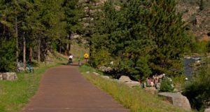
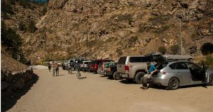
 The trail includes not only 3 miles of a paved multiuse trail, but features 3 bridges, 6 new formal river access points and multiple overlooks and boulder seating areas. Other improvements include two new parking lots and an expanded parking lot and restroom at Mayhem Gulch. The parking lots are a key component to bringing a new types of visitor to Clear Creek Canyon; cyclists, hikers and walkers.
The majority of the trail meanders along “quieter side” of the Creek, opposite of Highway 6. In doing so, the trail travels through a variety of landscapes, from open meadows, rocky overlooks, and riparian sections close to the Creek. It also gains some elevation in areas offering some great views down into the Creek. Areas that were disturbed by construction have been re-vegetated with native grasses, shrubs and trees.
On several occasions, I have had the opportunity to experience the trail as a fisherman. However; on a recent crisp Saturday morning, I put away my fly rod walked most of the trail to take in all aspects of the trail.
I t was encouraging to see extended families walking the trail, leaning over the guardrail at an overlook pointing to trout rising behind a large boulder. Joggers pushing strollers paused at the overlooks on the bridges to catch their breath. Cyclists were numerous and one group took advantage of the informal boulder seating areas to stop for a picnic lunch. There were crowds of climbers at all of the popular areas, and fisherman were ducking in and out of the willows along the banks.
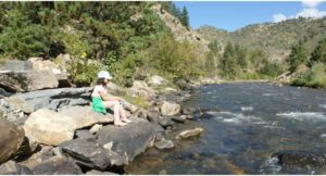
As hard as I tried to be a “pedestrian” and just simply walk the trail, I couldn’t stop myself from making mental notes of all of the new fishing access points to the Creek. With much of the trail being on the opposite side of the Creek from the road, there is a LOT of new creek access. I will honor the tradition of not divulging secret fishing spots, but I have discovered that this trail offers access to great new water that was either difficult or impossible to access in the past.
 My overall impression of the trail was extremely positive. The materials used through compliment the character of the Canyon. The improved parking areas provide additional spaces and greatly improve visitor safety and the new signage is clear and concise. The biggest improvement; however, is the trail. It allows visitors to disconnect from Highway 6 and truly immerse themselves in the Creek, the Canyon, and the Landscape.
The next evolution in Clear Creek Canyon will be the design and construction of the Mouth of Clear Creek Canyon. It will extend the existing multi-use trail associated with the Golden Mile through Downtown Golden upstream to Tunnel 1. The concept features two new pedestrian bridges as well as the proposed Welch Ditch Tail which will improve climbing access and connect the Peaks to Plains trail to Chimney Gulch Trail. Parking areas will be upgraded in two locations to accommodate the large demand in this stretch.


